Support for Emergency Assistance on Rehabilitation and Reconstruction in Central Sulawesi, Indonesia
Sulawesi Island is a seismically active region where earthquakes with large magnitude and shallow depth are dominantly observed, particularly in Central Sulawesi. On 28 September 2018, a magnitude of 7.5 earthquake struck the island with the hypocenter located in Donggala Regency, about 80 km to the north of Palu city, at a depth of 10 to 15 km. The earthquake triggered a devastating 4 to 7 high tsunami and a geological process known as liquefaction. According to the Indonesia’s National Disaster Management Agency (BNPB), 2,081 people had died, 1,075 people were reported missing, and 4,400 people had major injuries. The worst affected area was Palu city where over 1,700 people were killed. The affected areas suffered extensive damage to buildings, transportation network, and infrastructure. An estimated 68,000 buildings were heavily damaged, and the estimated damages reached up to USD 910 million.
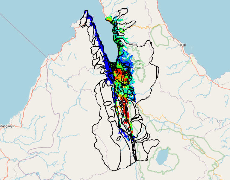
The Asian Development Bank (ADB) is implementing Emergency Assistance for Rehabilitation and Reconstruction (EARR) in Central Sulawesi, to support the Government of Indonesia on rehabilitation and reconstruction of damaged education, water supply, irrigation and flood protection infrastructure. The Geoportal is aimed at developing geospatial monitoring and evaluation (M&E) platform to provide information on critical infrastructure reconstruction, building, ground movements, and other information needed to support reconstruction monitoring after the 2018 Central Sulawesi earthquake. It is developed to support the National Disaster Response Information System (Indonesian: Sistem Informasi Tanggap Bencana - SITABA). The Geoportal provides satellite-based information generated from both optical and Synthetic Aperture Radar (SAR) data, for regular monitoring of land movement and reconstruction of buildings and infrastructures in the affected area.
Data and information available on the Geoportal are contributions of the following agencies:
- Ministry of Public Works and Housing (MPWH). As the EARR's executing agencies, the MPWH provides datasets on rehabilitation and reconstruction activities in Central Sulawesi such as activities on housing and resettlement, irrigation, etc.
- Asian Institute of Technology (AIT). As the project consultant, AIT manages the Geoportal and provides satellite-based analysis for the reconstruction monitoring based on the optical and SAR data.
- European Space Agency (ESA). Through the ESA's project 'Earth Observation for Sustainable Development – Disaster Risk Reduction', a series of ground motion or displacement maps of before and after the Central Sulawesi earthquake have been produced based on Sentinel-1 SAR data, with an accuracy to a few millimeters. The dataset is used as a basis for the follow-up works on the reconstruction monitoring carried out by AIT. The ESA also provides rapid damage assessment through the Copernicus Emergency Management Service.
- National Institute of Aeronautics and Space (Indonesian: Lembaga Penerbangan dan Antariksa Nasional - LAPAN). LAPAN provides Very High Resolution (VHR) satellite imagery through the 'One Data Policy' license to MPWH.
- Geospatial Information Agency (Indonesian: Badan Informasi Geospasial - BIG). BIG provides base map such as admin unit, transportation, building and utilities, irrigation and vegetation, and topography.